
Wildnote Export Library
Explore our comprehensive library of professional environmental reporting templates. From standard compliance reports to custom analytical exports, we have the templates you need to streamline your environmental data reporting.
26
Export Templates
6
Categories
PDF, Excel, CSV
Export Formats
24/7
Availability
Filter Exports
Browse Exports by Category
This library is organized by Export Category. Click the chevron to expand sections and explore our professional reporting templates.
Standard
| Export Name | Description | Best Uses | Preview | Format |
|---|---|---|---|---|
| Gallery Download | The Gallery Download export creates one or more .zip files of all photos in a project. Users are emailed when the files are ready for download. | Sharing high resolution photos with customers, storing original photos locally, or having photos available for alternate reporting methods outside of Wildnote. |
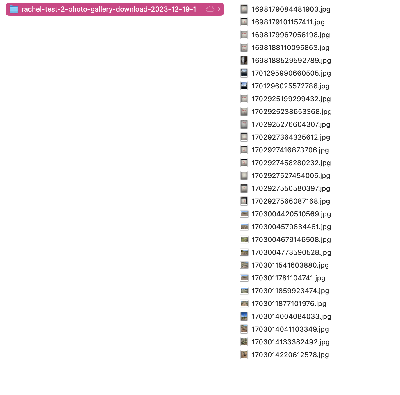
|
ZIP/JPG |
| Issue Tracker | Export issues to Excel | No Preview | Excel | |
| Location | Export all project locations to Excel | No Preview | Excel | |
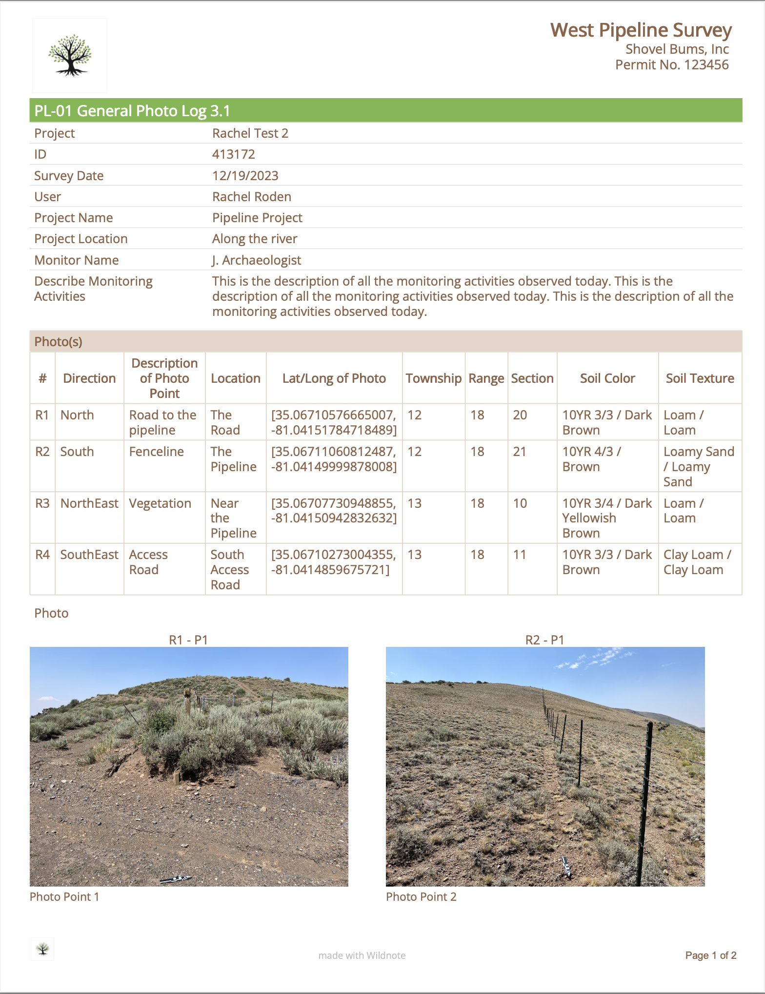
| Photo Log | The Photo Log can save hours of time. Export photos from one or more survey form templates for a single date or date range. Choose the 2-photo per page option which includes the additional photo metadata of Survey ID, user, location, coordinates, datum, speed, heading, altitude, accuracy and photo captions, or the 4-photo per page option which only includes photo captions. Sort photos by date or a location such as nests, poles, or sampling points. Control which photos appear in the report by removing unwanted photos during preview. | Showing customers/stakeholders project progress, comparing photos in the same location over time such as SWPPP, pre/post construction or restoration plots, and incorporating the Photo Log into a larger report as an appendix. |
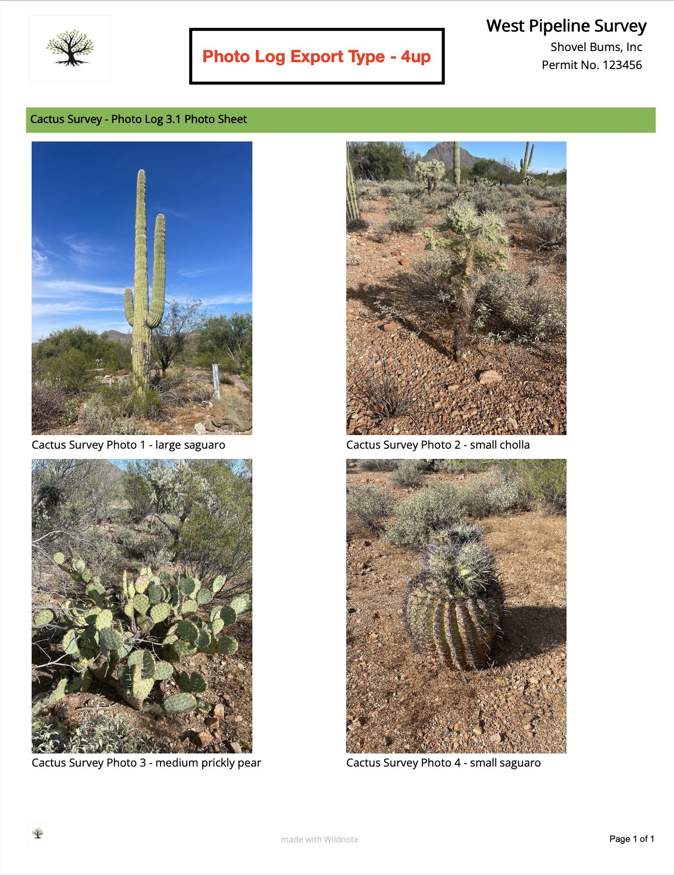
|
|
| Photo Point Export | The Photo Point Export is an easy way to quickly produce a report with pre/post photos of a project or event taken in the same survey and exported side-by-side. It works with the PL-02 Photo Point Log form and allows users to capture pre/post construction and pre/post storm photos, as well as ongoing photos for the duration of a project. | Photo reporting on the the conditions before and after an event like construction, storms, or fires. It can also be used for reporting on the conditions at a location over time. |

|
|
| Species List | The Species List is a tabular excel export of observed species sorted by plants and wildlife. Compile species data from multiple survey forms at one time. Species data includes Class, Family, Scientific Name, Common Name, Native Status, Growth Habit, Listing Status, Invasive Status, Indicator, Symbol, Listing Notes, and total Count. Because this is a tabular excel file, you can easily edit as needed. | Documenting species during pre-construction, post construction, and restoration for easy inclusion in any larger report such as CEQA/NEPA documentation. |
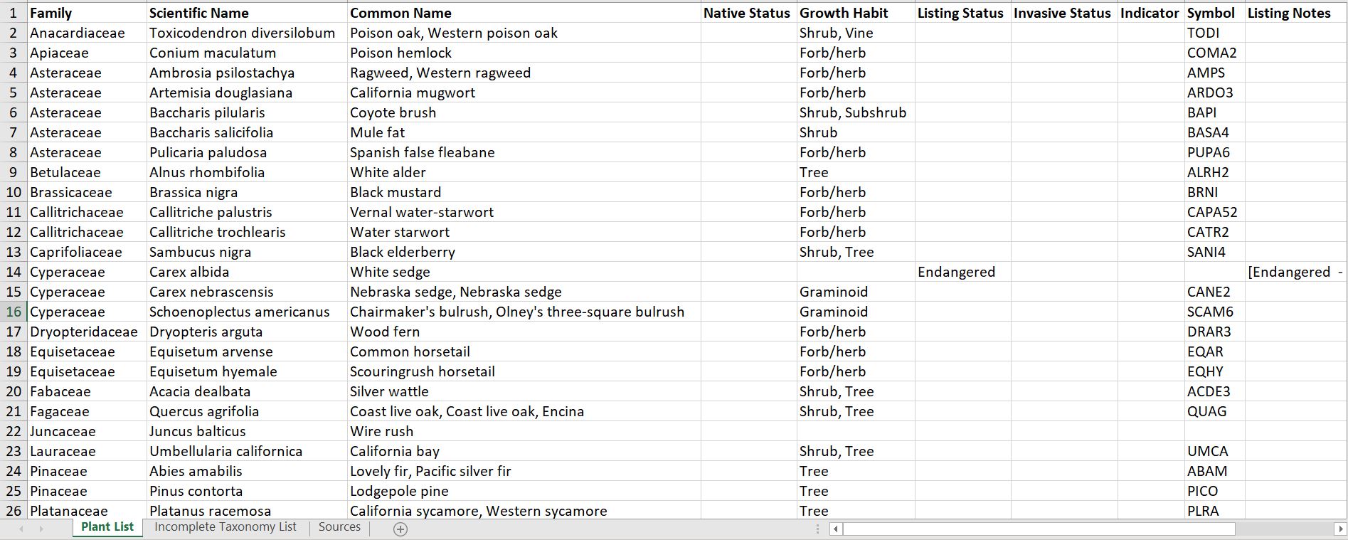
|
Excel |
| Standard Compilation | The Compilation PDF is our most popular export allowing you to collate multiple surveys into a single report with photos and captions seamlessly integrated. Export data from multiple survey form templates at one time. Choose from two layouts, and use advanced features to filter your exported data by location or tag. Additional parameters include a variety of survey sort options, header control, logo control and more. | Daily/weekly/monthly/annual reports, filtered reports showing action items such as SWPPP corrective actions, or nest buffer changes, and comparison report showing changes for a single location over time. |
|
|
| Success Criteria | The Success Criteria is a powerful tabular excel export with a flexible reporting framework based on the tagged RES-01 Vegetation Monitoring Survey Form found in the Wildnote Library. This export collates vegetation data according to growth type such as woody and herbaceous and includes scientific and common name, indicator status, native status, and invasive/nuisance details for each plant. The relative and absolute percent cover is calculated based on individual plot and aggregated plots. The totals for native, invasive, FAC or Wetter, and Native Species Richness is calculated based on individual plot and aggregated plots. | Mitigation banking projects and restoration projects that require success criteria reporting on a regular basis to the IRT or other stakeholders where timely reporting is paramount to credit release. |
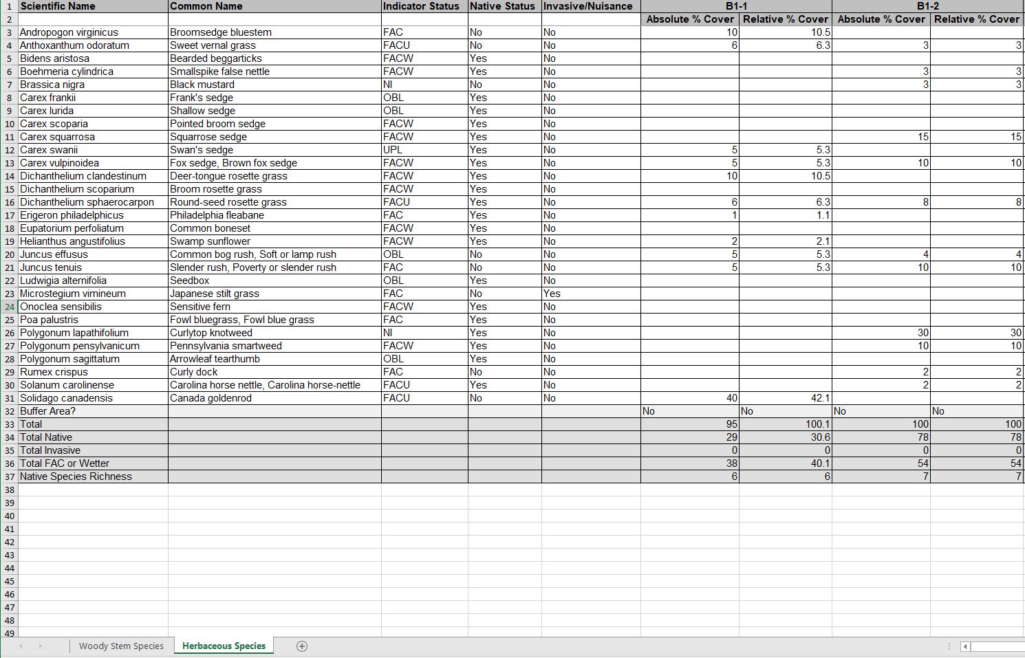
|
Excel |
| Tabular | The Excel export pivots your data so that each survey question becomes a column in the report. Sections and repeatable sections are in their own tabs, with each tab retaining unifying information including Survey ID, date, and location. If you need to upload your data to another database, you can create custom API column names during the survey form building process and export the pivot table with those names. Data can also be filtered by tags. | Data analysis, data qa/qc for large data sets, moving data from Wildnote into another database, and data display in a grid view. |
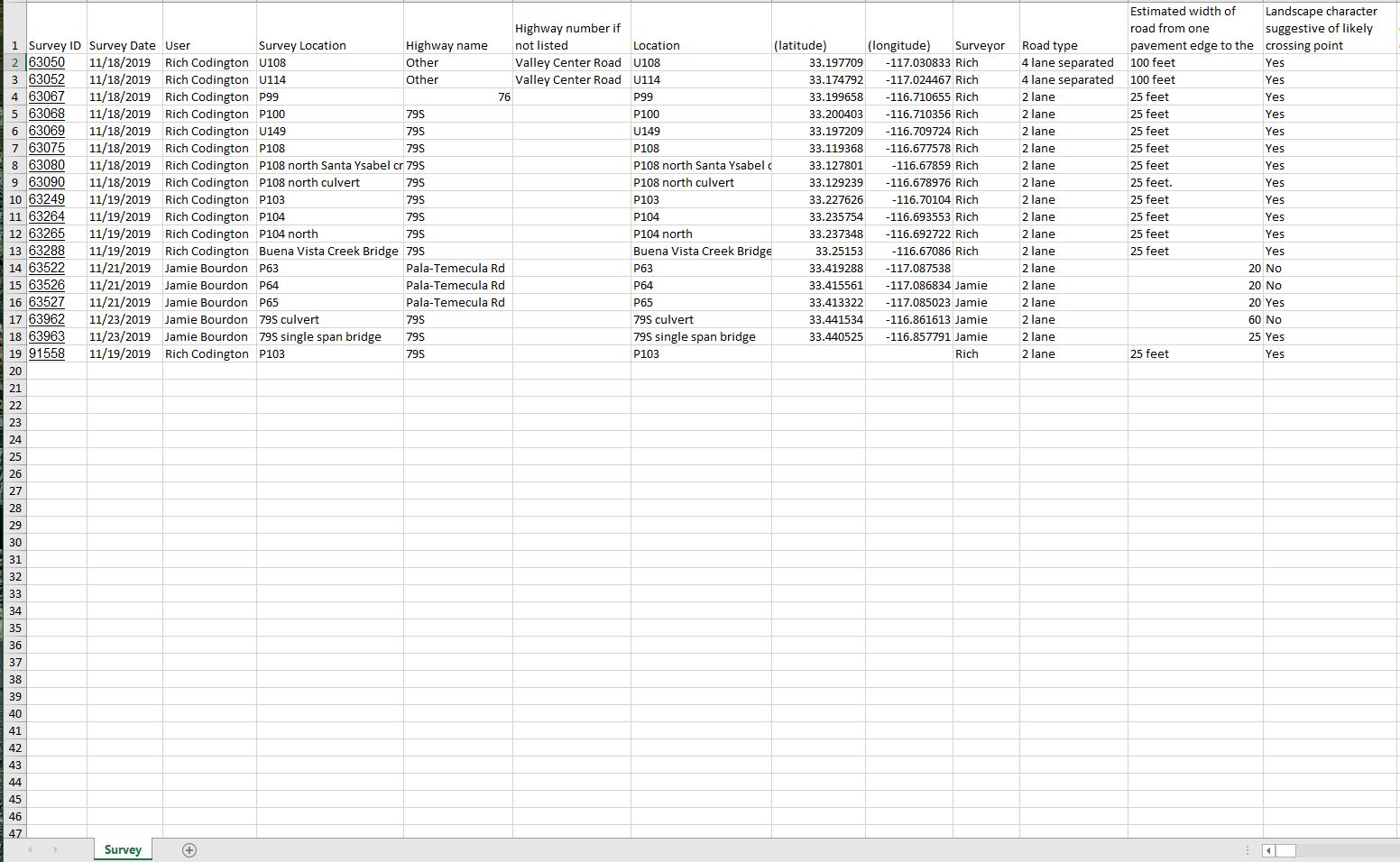
|
XLSX |
Report Builders
| Export Name | Description | Best Uses | Preview | Format |
|---|---|---|---|---|
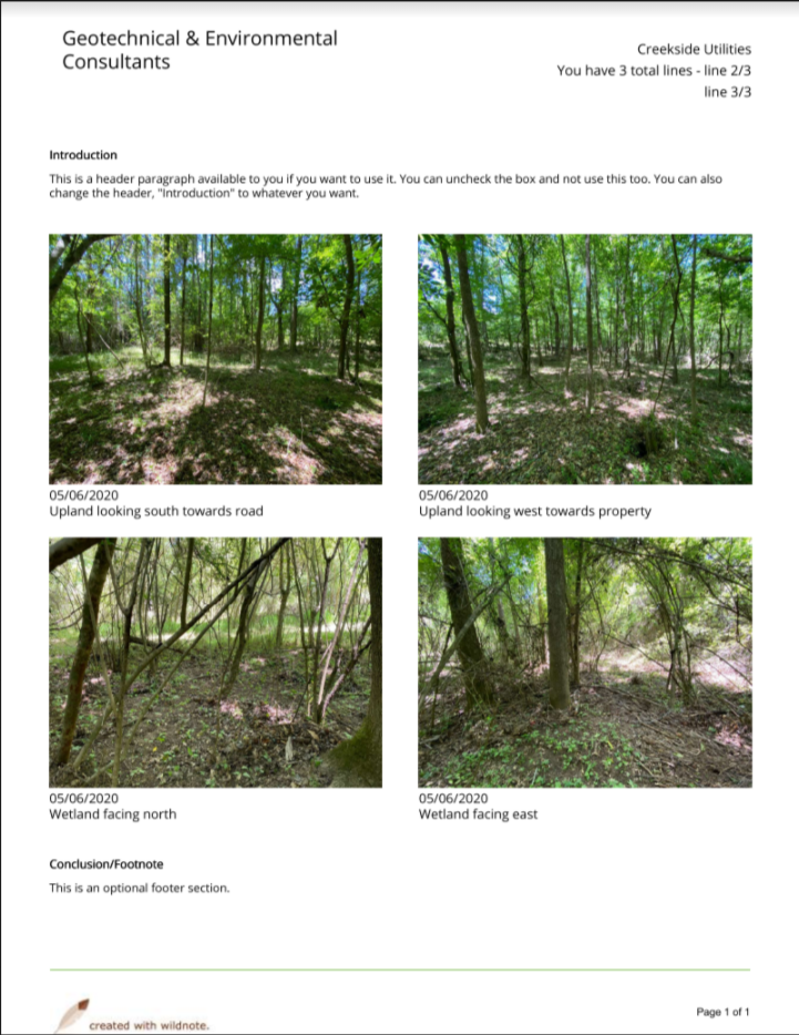
| Photo Log Builder | The Narrative Photo Log Builder gives users the option of adding introductory and concluding paragraphs or tabular data to the photo report. Users control which photos are included, photos can be sorted by date or location and appear four photos per page with date and location name under each photo. The captions and page numbers are optional, and photo captions may be modified for the report. | For those needing a flexible builder that allows additional narrative to support project photos, the ability to easily select which photos will be included, live caption editing, and location information such as a wetland sampling point attached to each photo. Great for wetland and restoration reporting. |
|
|
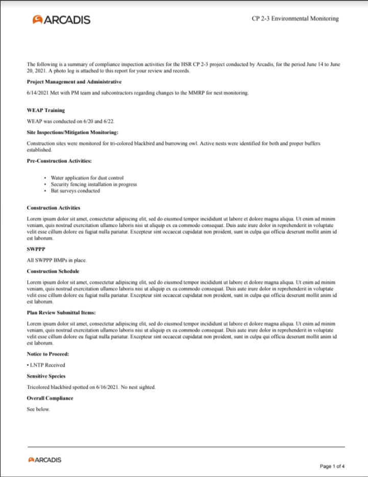
| Report Builder | The Report Builder allows users to construct a report consisting of customized sections (including tables) informed by real time queries of collected tagged survey data. Choose which photos to include, and re-caption as necessary. Choose to include a summary checklist that shows overall compliance for specific questions over the specified time period (Note: Some custom set-up is required - please contact customer support). | Any Daily/Weekly/Monthly/Annual reporting for any type of project, but especially useful for all aspects of construction compliance reporting. |
|
Agency / Cultural
| Export Name | Description | Best Uses | Preview | Format |
|---|---|---|---|---|
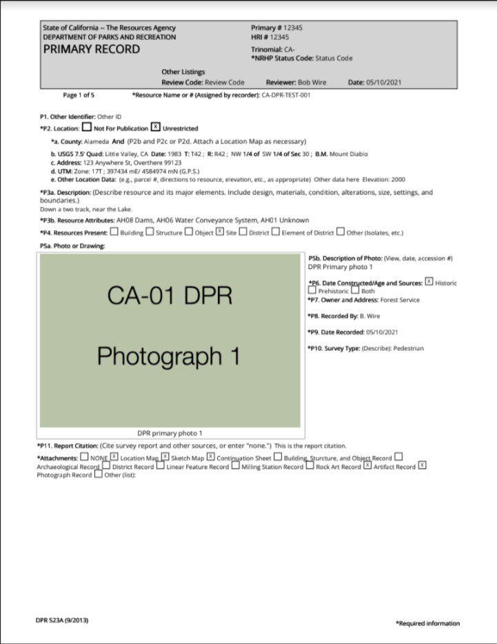
| California DPR Complete Site | The Wildnote California DPR export removes the headache of using a word processing program to compile a complete site record, and does all the work for you from data collected on mobile devices in the field. It pulls from individual CA DPR forms to build a complete site record based on project location. It includes form types: CA DPR 523A Primary Record, CA DPR 523C Archaeological Site Record, CA DPR 523H Artifact Record, CA DPR 523J Location Map, CA DPR 523K Sketch Map, CA DPR 523I Photograph Record, and adds CA DPR 523L Continuation Sheets automatically. Easy data entry as well as QA/editing. Once the data has been finalized, a single click produces a complete site form formatted exactly as required by the agencies. | CRM firms reporting CA archaeological sites to the state and federal agencies. |
|
|
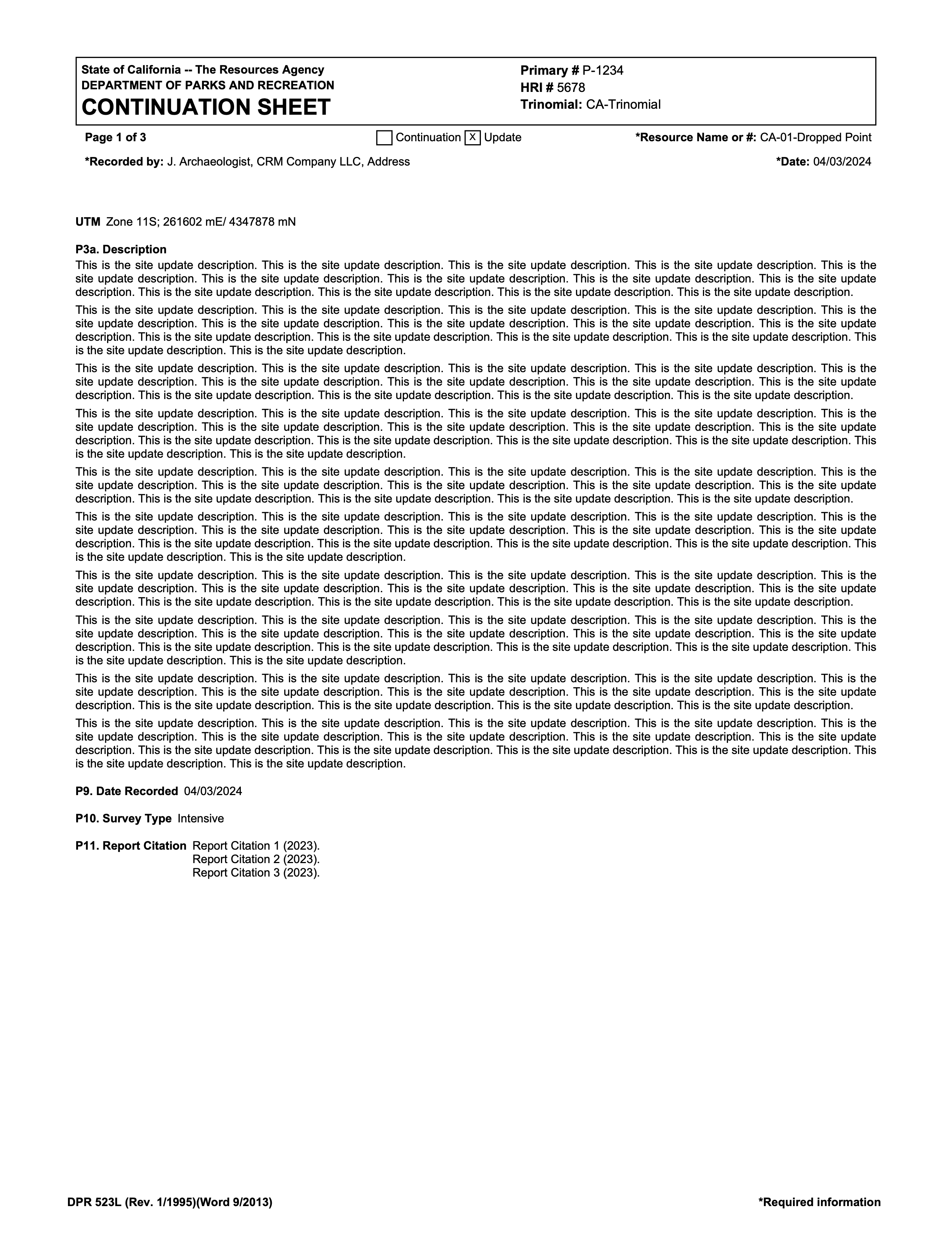
| California DPR Update Site | The CA DPR Update Site export is used in conjunction with either the CA DPR Site Update [Photos] or the CA DPR Site Update [No Photos] forms. It exports the data from that form directly to an official DPR Continuation Sheet with "Update" automatically checked. You can choose to include photos or not based on the form, and the questions included in the export can be customized with the assistance of Wildnote Support. | The California DPR Update Site export is best used when a Complete DPR is not required. It will accomodate any data that must be collected and reported for a site update. |
|
|
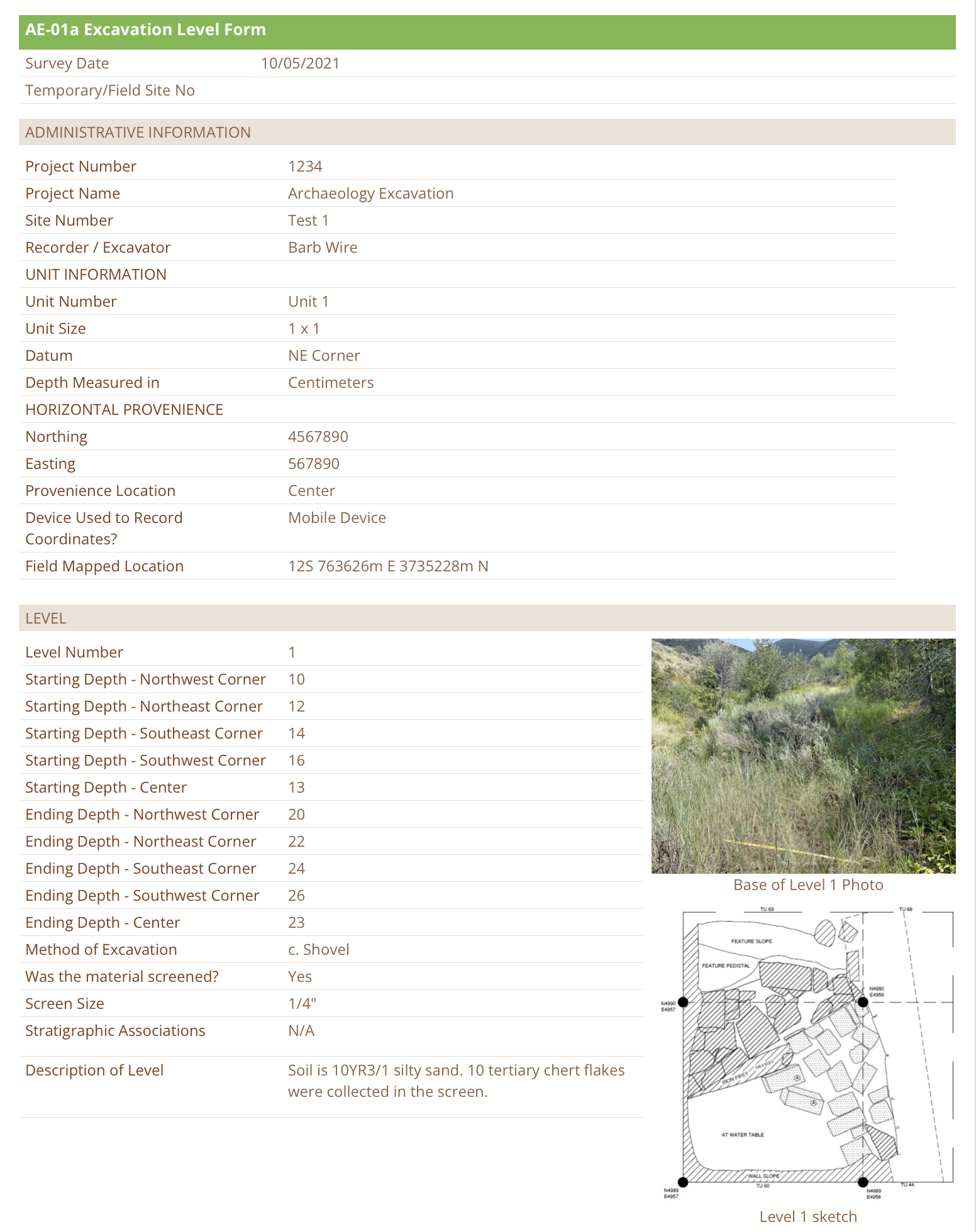
| E-1 Excavation Level Report | The E-1 Excavation Level Report export compiles all the data recorded for an archaeological excavation and exports it together. You can include the data from an entire project, or just a single excavation unit. The export is organized with the project admin info at the top, and then each level below with the photos and sketch maps situated next to the level data. | Easy visual analysis of the unit data, showing customers/stakeholders project progress. |
|
|
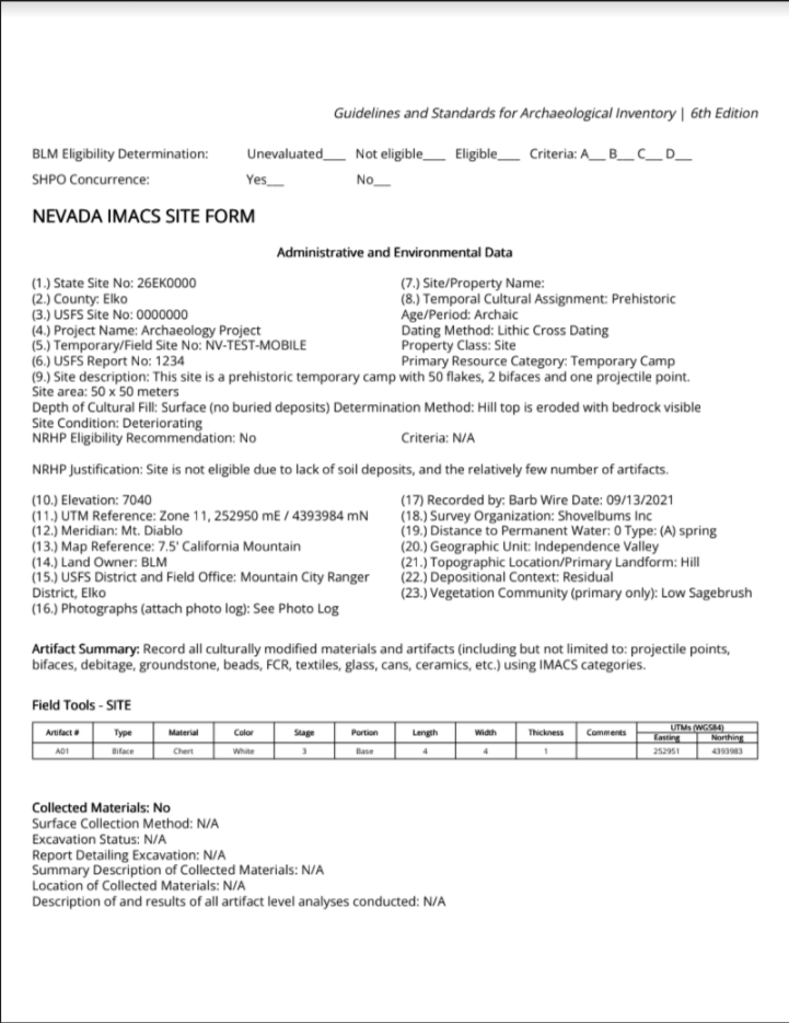
| Nevada Complete Site | The Wildnote Nevada Complete Site export removes the headache of using a word processing program to compile a complete site record, and does all the work for you from data collected on mobile devices in the field. It pulls from individual NV IMACS forms to build a complete site record based on project location. It includes form types: NV-01 IMACS Site Form, NV-02 Sketch Map, NV-03 Location Map, NV-04 Feature Record, NV-05 Field Glass Inventory, NV-06 Historic Ceramic Inventory, NV-07 Miscellaneous Artifact Inventory, NV-08 Tin Can Inventory, NV-09 Debitage Inventory, NV-10 Prehistoric Tool Inventory, NV-11 Photo Log. These forms allow for easy data entry as well as QA/editing. Once the data has been finalized, with one click you have a complete site form formatted exactly as required by the agencies. | CRM firms reporting NV archaeological sites to the state and federal agencies. |
|
|
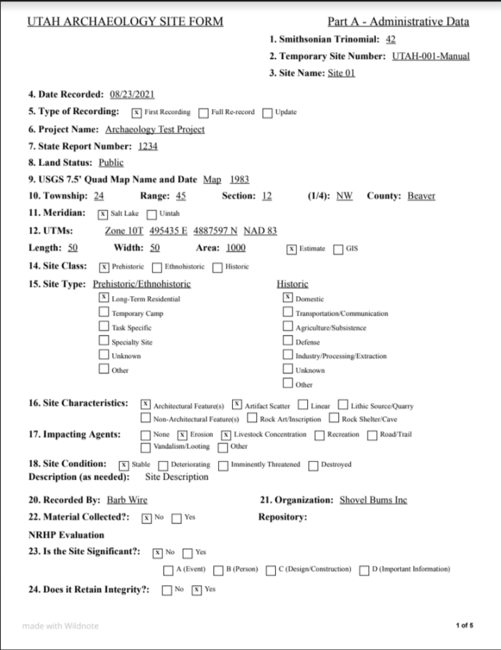
| Utah Complete Site | The Wildnote Utah Complete Site export removes the headache of using a word processing program to compile a complete site record, and does all the work for you from data collected on mobile devices in the field. It pulls from individual UASF forms to build a complete site record based on project location. It includes form types: UT-01 Part A, UT-02 Part B (a through f), UT-03 Part C (a through e), UT-04 Rock Art, UT-05 Features, UT-06 Photo Log, UT-07 Sketch Map, and UT-08 Location Map. These forms allow for easy data entry as well as QA/editing. Once the data has been finalized, with one click you have a complete site form formatted exactly as required by the agencies. | CRM firms reporting UT archaeological sites to the state and federal agencies. |
|
|
| Utah Tabular | Use the Utah Tabular export to create the tabular site database for the entire project in the format required for submission to the UTSHPO. It pulls the data together from UT-01 Part A, UT-02 Part B - Admin, and UT-05 Features to create one spreadsheet. | This export creates the UTSHPO formatted tabular list of all sites in the project, and is best used at the end of the project after all QA/QC has been completed and all data has been verified as correct. | No Preview | Excel |
Agency / Wetland / Restoration / Bio
| Export Name | Description | Best Uses | Preview | Format |
|---|---|---|---|---|
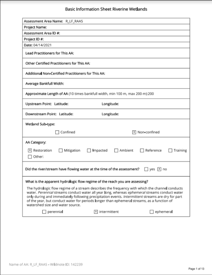
| California Rapid Assessment Method | The CRAM exports are precisely formatted according to the official Level 2 Committee standards found in the latest Riverine, Slope and Depressional Field Books. Data can be exported by date range or individual survey, photos are automatically incorporated and final CRAM scores are calculated and auto-filled. | Any project that has a CRAM requirement. This tool saves time no matter how many assessment areas there are. |
|
|
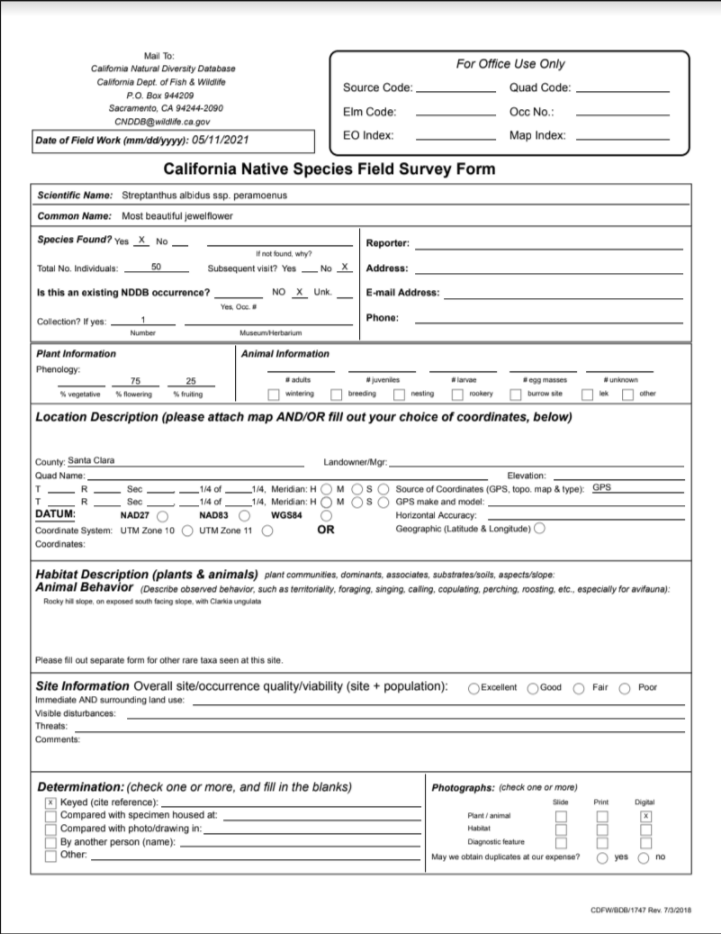
| CNDDB | The California Department of Fish and Wildlife's (CDFW) California Natural Diversity Data Base (CNDDB) export is formatted to yield the exact agency export required for PDF submission to the CDFW. You must start with the CNDDB Survey Form found in the Wildnote Library. | Tracking your CNDDB sightings throughout the year across all projects using Wildnote so that you don't have the mad dash at the end of the year to renew your take permits. |
|
|
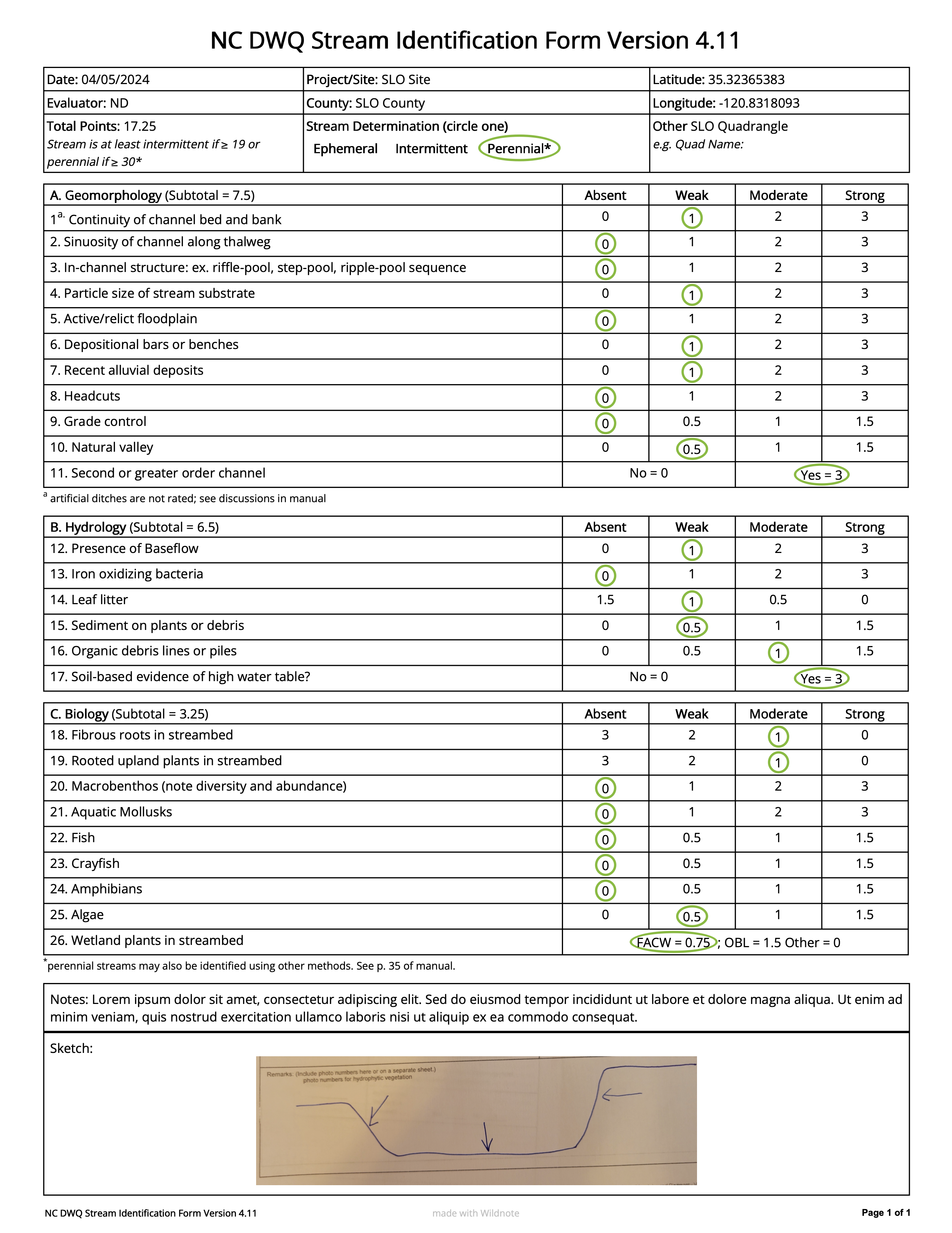
| NC DWQ Stream Identification | This export conforms to the form specifications provided in the NC Division of Water Quality –Methodology for Identification of Intermittent and Perennial Streams and Their Origins v. 4.11. Optional ability to include stream photos. |
|
||
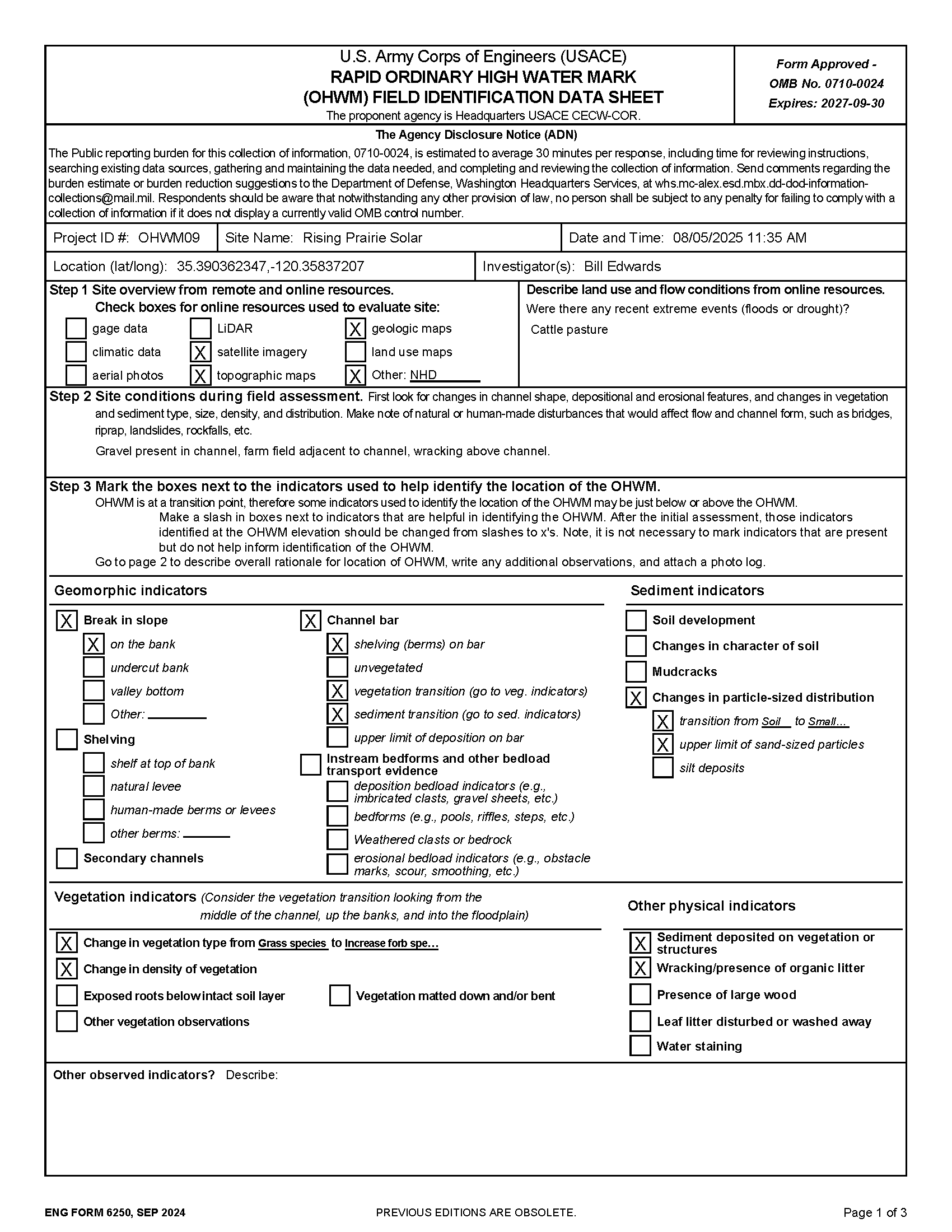
| (OHWM) USACE Rapid Ordinary High Water Mark | Create a USACE-formatted OHWM report directly from your form. Includes indicators by bank, evidence summary, determination, and photo log. Conforms to the OMB No. 0710-0024 Expires: 2027-09-30 | For use in project reports or environmental assessments for developers, utilities, or municipalities who need clear documentation that OHWM calls were made correctly and need to comply to USACE regulatory reporting standards. |
|
|
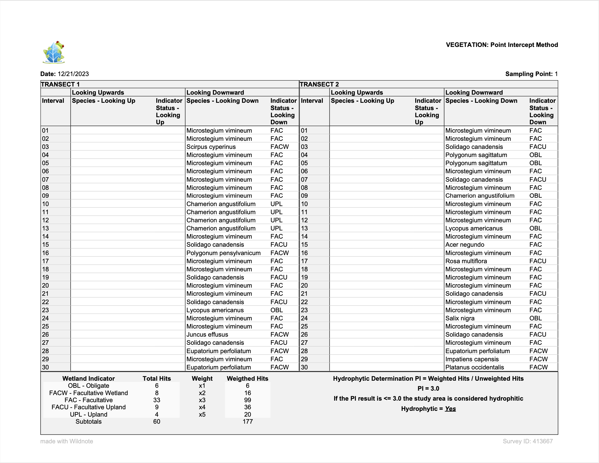
| Point Intercept Method | The Point Intercept Method export is formatted to comply with the US Army Corps of Engineer’s (USACE) Point Intercept Method form. The point intercept method is a data collection technique used in the USACE wetland delineation protocol to determine the presence of hydrophytic vegetation, one of the three criteria required to classify an area as a wetland. Collect data using the Point Intercept form in the Wildnote library and then export it in the format required for submission to the USACE. | Quickly and efficiently enter data in the mobile app using the Point Intercept Method and then export the data using this export for submission to the USACE. |
|
|
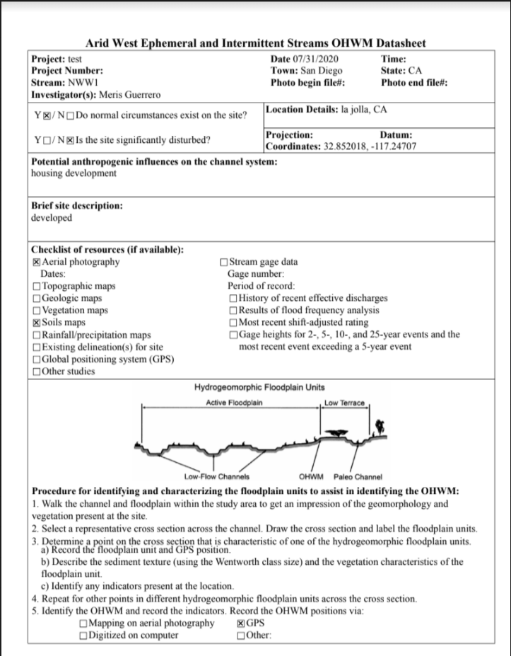
| USACE Ordinary High Water Mark-Arid West | The USACE Ordinary High Water Mark-Arid West export is formatted according to the official USACE OHWM found in July 2010 Manual. Data can be exported by date range or individual survey and photos are automatically incorporated. | Wetland projects where supporting field data must be submitted according to USACE regulatory standards |
|
|
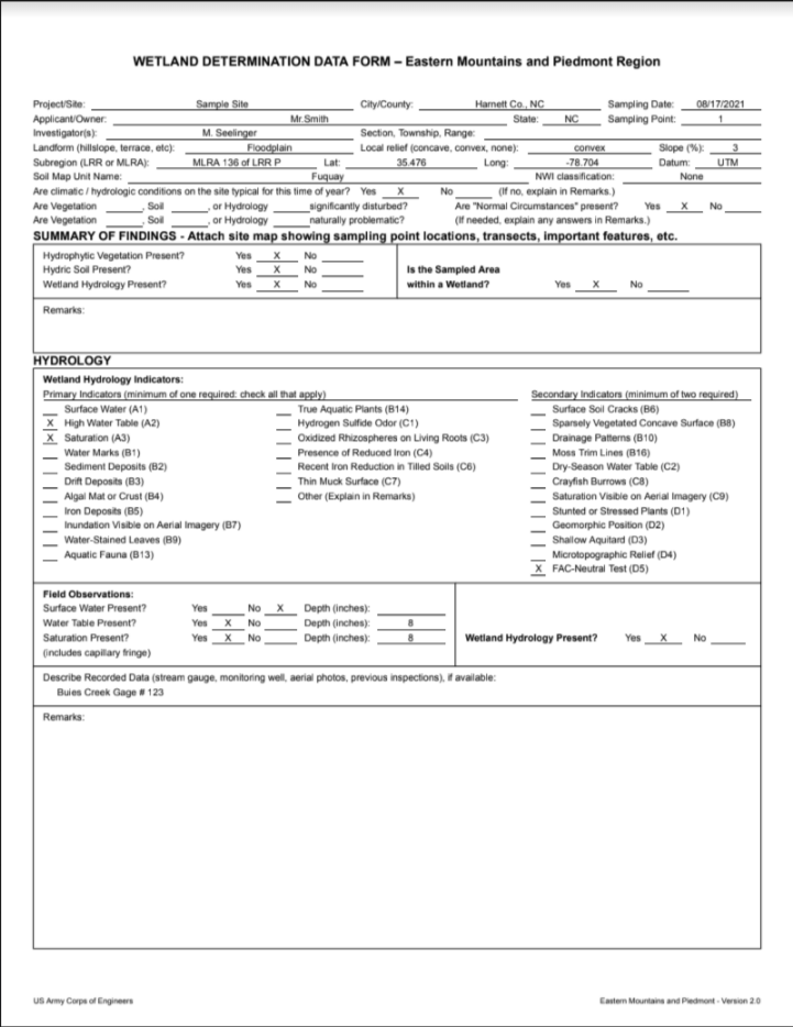
| USACE Wetland | The USACE Wetland export is formatted according to the official Wetland Determination Data Forms for all 10 USACE regions. Export all data at one time in order of sampling point. Auto-populates indicator status, dominance, Dominance Test/Prevalence Index worksheets, FAC-neutral and Rapid Test. | Wetland projects where supporting field data must be submitted according to USACE regulatory standards |
|
Geospatial
| Export Name | Description | Best Uses | Preview | Format |
|---|---|---|---|---|
| Geospatial Google Earth | The Geospatial - Google Earth export collects all dropped points and geotagged photos taken in a project, as well as geotagged locations, and creates a KML file. Customize by date range, survey form type, and location. The labels displayed for photos, points and locations may be assigned using a specific tagging convention on the survey form question and the data displayed in the data block for photos and points may also be customized using tags. | Showing customers/stakeholders project progress, creating maps to visually track project progress, tracking non-comliance or issues related to a particular location and data QA/QC . |
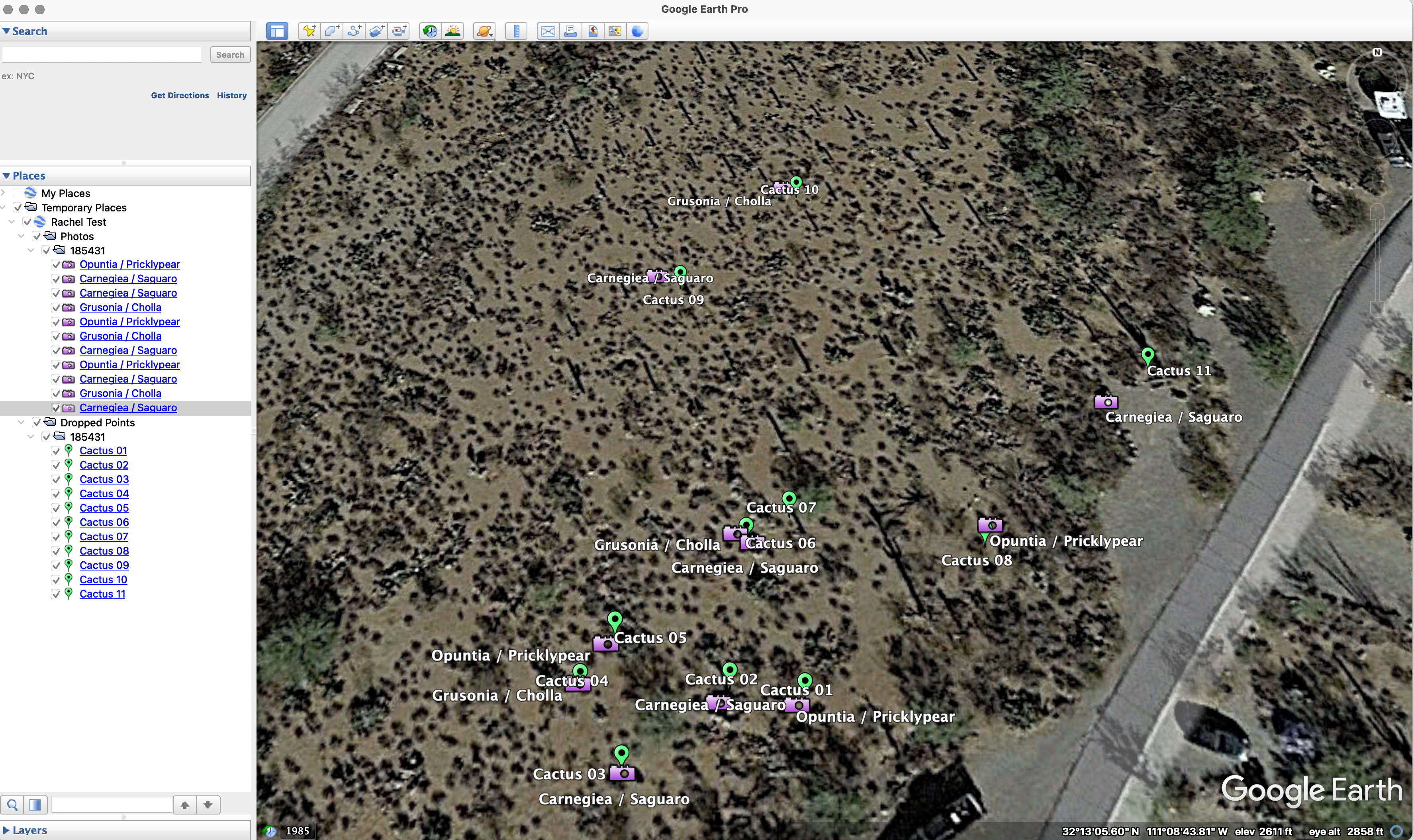
|
KML |
| Geospatial Open Source | The Geospatial - Open Source export is compatible with ESRI’s ArcGIS Pro, ArcGIS Online, and other GIS software. The GeoJSON output consists of one file for top-level survey data and additional files for each set of repeater data. Photos are not included in the output. Users can define custom joins using api_column_name set up in the survey form builder, and filter the export based on tags set up on the survey form template. | For those needing data in a geospatial format and require more flexiblity than a GeoDatabase. Usable in a variety of GIS software programs. |
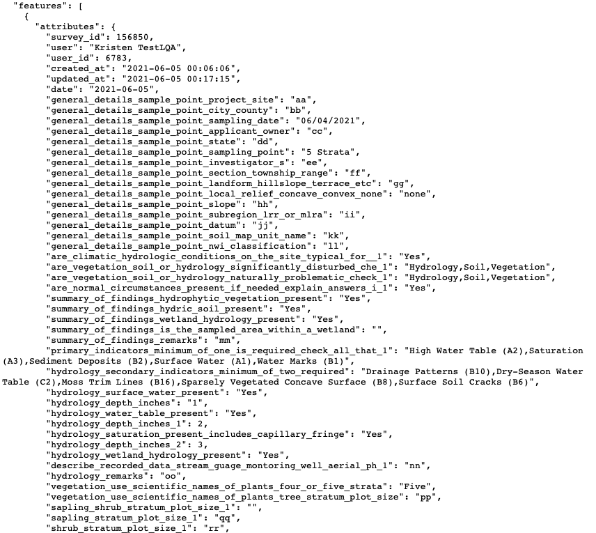
|
GeoJSON |
Streams
| Export Name | Description | Best Uses | Preview | Format |
|---|---|---|---|---|
| (OHWM) USACE Rapid Ordinary High Water Mark | Create a USACE-formatted OHWM report directly from your form. Includes indicators by bank, evidence summary, determination, and photo log. Conforms to the OMB No. 0710-0024 Expires: 2027-09-30 | For use in project reports or environmental assessments for developers, utilities, or municipalities who need clear documentation that OHWM calls were made correctly and need to comply to USACE regulatory reporting standards. |
|